RRS James Cook

RRS James Cook
RRS James Cook

Monday, 29 October 2018

Blown away by the eons of time


By: Chief Scientist, Bramley Murton.

The week-end has been dogged by lumpy weather. A nasty storm cyclone has hit us and we have had to run away, 200 miles to the North. The storm is unusual for this time of year, and is exceptionally deep. It has tracked from the west right across the Rio Grande Rise, lashing the ship and stopping science. Luckily we recovered all our gear before it hit.
A nasty wee storm finds us and sends us packing for the weekend.


The Autosub6000 being recovered after its second mission over the Rio Grande Rise.

Just after recovery, within a couple of hours, the sea picked up and we decided to postpone the next HyBIS dive. This was a pity as we have made some interesting discoveries on the last dive. However, without the heave compensation working on our main winch, we can’t use HyBIS in heavy seas as it is too hard to control. The break will give the HyBIS team time to make some minor adjustments to the motors and lights to optimize the next dive after the storm passes.

The sea get a wee bit lumpy shortly after recovering the Autosub6000.

The last HyBIS dive was made over the southwestern side of the Great Rift. Here we started at the top edge of the scarp and made our way slowly down a few terraces. The sight was amazing: ferromanganse crusts were there, as we predicted, but they have a polygonal pattern on the surface, resembling a large honeycomb. Closer inspection shows the crusts are being eroded by patches of sand in the centre of the polygons leaving them to resemble cracked dried mud.

Polygonal pattern to ferromanganese crusts covering lavas on the edge of the Great Rift.

Further down the slope we found lavas exposed. These were also polytonally jointed. The jointing on the lava surface turns into vertical joints (cracks) underneath, forming columns. This type of structure is well known in lava flows from land – a classic example is the Giant’s Causeway in County Antrim, Ireland. The difference here is that the lavas we are looking at are 900m below sea-level, yet they look like subaerial eruptions. In contrast, submarine lavas form distinctive pillow shapes. This is because the water quenches the lava and forms a skin, like an amniotic sack, that stretches as the lava fills it until it forms a bulbous shape. Where we get sheet flows on the seafloor, they rarely, if ever, form columnar jointing. Is this evidence that we are looking at eruptions on the Rio Grande Rise when it was an island?
Columnar-jointed lavas on the edge of the Great Rift, Rio Grande Rise.
The vertical face of the scarp exposing the lava flow. The scarps is 30m high and forms the edge of the Great Rift.
Red clay and mud underneath the columnar jointed lava, and on top of another lava flow, 900 metres below sea level.

Our suspicions were confirmed at the bottom of the terrace where the columnar-jointed lava gave way to an underlying bed of red clay. The clay deposit merged into the top of another lava flow beneath the first. Geologists recognize this mud as a bole, the top of a lava flow that has been weathered by sub-tropical and humid conditions, oxidizing the lava and turning its iron content red, and turning the rock into clay minerals. This is in effect an ancient soil, or as we call it, a palaeosoil. Millions of years ago, volcanoes erupted lavas on the Rio Grande Rise when it was an island. Sun and rain eroded the top and transformed it into soil. Plants probably grew in the sunlight and who knows what animals grazed on them. Then, after thousands of years, the volcanoes erupted again and buried the landscape in another flow of white-hot lava and everything was incinerated. As it cooled, the lava contracted forming the columnar jointing we see today. This was probably followed by further cycles of weathering, soil formation, plants growing, animals grazing, lava eruptions and incineration. We are just seeing a snap shot in the eons of time that have formed the Rio Grande Rise when it was the equivalent of a sub-tropical Iceland, and long before it was drowned and submerged beneath the South Atlantic.

Back up on the top of the scarp we see the lavas give way to a sediment-covered flat seafloor strewn with large rounded boulders. These are made of the black lava, but are smooth and round. Only in areas where there is very high energy can such boulders form. Areas such as the beds of fast flowing rivers, or on the sea shore where waves can crash and tear at the cliffs, dislodge chunks of rock and roll them around until they form smooth and round boulders. Certainly not at the bottom of the ocean, 700m below sea level, where such waves can’t affect the seafloor. Here the energy is low, and currents are slow, moving only the smallest of sand grains. Here, then, we are seeing evidence for the drowning of the Rio Grande Rise, when the sub aerial lavas became sea cliffs and the waves churned the rocks into a boulder strewn shore.
Boulders strewn over the seafloor close to the edge of the Great Rift are evidence that this was once a sea shore where waves crashed and tore at the cliffs, long ago as the Rio Grande Rise was drowned.

Further back from the edge of the Great Rift, the boulders give way to a hard seafloor covered in calcareous sands. These sands are derived from the skeletal remains of plankton in the overlying ocean. The sediments are thin, only a few tens of centimeters, and the seafloor underneath is hard when HyBIS lands to take a scrape. The underlying seabed is also calcareous, made of crushed carbonate shells forming a sandstone. Was this once a sandy lagoon behind the cliffs and boulder strewn seashore? Almost a kilometer back from the edge of the Great Rift we come across an increasing number of chunks of black ferromanganese crust lying on the white pelagic sediment.  Where have they come from? The answer lies another 100m west, where we come across a ledge that cuts across the seascape.
Terrace with ferromanganese crust on the top overlying a calcareous sandstone.

Only 2 metres tall, the ledge is capped by 20cm thick layer of black crust. Underneath the crusts is the hard calcareous sandstone seafloor, here eroded and exposing the layers of crushed shelly sand. The edge of the ledge is undercut and pieces, some a metres across, of the crust have fallen off or are overhanging the ledge. HyBIS tries to take a sample, but it is too big. Eventually we get a couple of pieces that fill the basket. Another beach terrace? Perhaps, but this one has been cemented and covered by the ferromanganese crust that we are searching for. We know that the crusts grow at about 1 to 3 mm per million years, so again, we are confronted by a scene that has been frozen in time for tens of millions of years; a fossil shore line from the distant past, now drowned and lost beneath the stormy South Atlantic ocean.

Friday, 26 October 2018

First sight of the Rio Grande Rise


By: Chief Scientist, Bramley Murton.

The past couple of days we have been diving with HyBIS over the northern side of the great rift that divides the Rio Grande Rise in two. The Rio Grande Rise is a volcanic plateau formed 80 million years ago when a hot spot in the mantle underlay the Mid-Atlantic Ridge. As the African and South American tectonic plates separated, the hotspot caused an excess of volcanism generating an island rather like Iceland. The trail of the hotspot can be seen on each side of the Mid-Atlantic Ridge as the Walvis Ridge in the east and the Rio Grande Rise in the west. With time, the island plateau subsided beneath sea level to its present position we see today.
The tectonic position of the Rio Grande Rise and its conjugate, the Walvis Ridge.

The Rio Grande Rise, the Great Rift, and the location of our study area.

Prior to diving, we have to carefully plan the dive so that we know exactly what we are aiming to see – and each dive aims to test a hypothesis. In our case, we are looking to see if the cobalt rich crusts vary in outcrop and thickness with increasing distance from the edge of the Great Rift. The reasoning is simple: the Great Rift is over 1400m deep and guides the direction of currents and tides within it. As these moving water masses approach the walls of the rift, there is friction in the form of turbulence and eddies that create a more energetic environment, suppressing sediment accumulation and allowing the crusts to grow. This energetic environment is likely to be different to the north and south of the rift, as a result of geostrophic effects that cause the currents to turn. Further away from the edge of the rifts, the energy is likely to be less, and we expect to see an increase in the extent and thickness of the sediment cover. Hence our dives are designed to survey and sample at different locations with increasing distance from the rift walls.

Tim Le Bas, our survey and data manager, plots the locations of the dives on our new bathymetry maps we have made with our multibeam echo sounder system. We then transfer the maps to the HyBIS team. After launching the HyBIS, we start-out across the seafloor making a detailed video survey and sampling the rocks and biology.


Co-chief scientists Paul Lusty (standing) advises Tim Le Bas where to place the tracks for the next HyBIS dive mission.

 Launching the HyBIS is a quick procedure. The vehicle is prepared for the dive in a covered hanger inside the ship and wheeled out under the gantry where it is lifted into the air and dropped into the water. Floats are attached to the cable to keep it above the HyBIS when it lands on the seafloor. The whole operation takes about ten minutes. Recovery is the reverse, and is equally as fast.

The deck crew launch our HyBIS robotic underwater vehicle over a calm sea from the strarboard side of the side of the RRS Discovery as evening draws in.


The science team watch as the HyBIS ‘flies’ across the seafloor.

Meanwhile, the AUV team have been struggling to prepare the Autosub6000 robotic submarine for its first dive. One of the risks with shipping delicate equipment across the world is that things can be bumped in transit. We think this had happened to our internal navigation module, and as a result the team have spend a lot of late nights integrating a spare system in the vehicle. It is now ready for its first mission.

The robotic submarine Autosub6000 being prepared for its first mission over the Rio Grande Rise.

ENDs

Thursday, 25 October 2018

Discovery voyage DY094: Minerals and life at the Rio Grande Rise


By Bramley Murton, chief scientist


The Rio Grande Rise is a lost land of dinosaurs, ravines and plateaus the size of Wales that formed 72 million years ago by huge eruptions of volcanic lava and drowned 22 million years ago. Now 700 m below sea level, the Rio Grande Rise lies 1400 km east of Brazil, in the South Atlantic. Surrounded by water over 3000 m deep, the relatively shallow Rio Grande Rise is of interest for seafloor mineral deposits rich in iron, manganese and other metals that are important to modern society.
Map showing the location of the Rio Grande Rise and mineral exploration blocks (in red) licensed to the Brazilian Geological Survey (courtesy of GEBCO).

Two of these metals in particular are critical to any future effort to reduce our dependence on hydrocarbons: cobalt and tellurium. Cobalt is essential in rechargeable batteries that are needed if we are to move to electric vehicles. Tellurium is essential for high-efficiency solar-electric power generation. Our voyage aims to enhance understanding of the processes controlling the formation and composition of these deep-ocean mineral deposits and the biology that colonises them.

Cobalt-rich crusts recovered during the MarineE-tech programme in 2016 by the robotic submarine Isis, North Atlantic (courtesy, B Murton).

Cruise DY094 sailed from Santos, Brazil, on the 20th of October with a scientific team from the National Oceanography Centre, British Geological Survey, University of Edinburgh and the University of Sao Paulo. We have with us the autonomous robotic submarine Austosub6000 and the remotely operated submarine HyBIS. With these machines, we will explore the Rio Grande Rise, mapping it in great detail with our sonars and filming and sampling the seabed mineral deposits and their biology.


RRS Discovery in Santos with the yellow Autosub6000 on the after deck (courtesy: Paul Lusty).

Entering the secure dock areas and boarding the RRS Discovery at the port of Santos, Brazil. RRS Discovery in Santos with the yellow Autosub6000 on the after deck (courtesy: Paul Lusty).


Science team discuss their plans for the voyage while on their way to the Rio Grande Rise, on board the RRS Discovery  (courtesy: Paul Lusty).


Map showing the location of one of our study areas where we have started exploring the sea floor (courtesy of our partners at the University of Sao Paulo).


So far we have seen a varied and fascinating seafloor includes a huge rift over 1500 m deep and 250 km long that cuts the Rio Grande Rise in two, mysterious sinkholes, and the ancient remains of beaches long since drowned under hundreds of metres of water. Although ours is purely a scientific voyage of discovery, our results will tell us a lot about the potential value of the mineral deposits to future renewable energy industries and how vulnerable the life on the seafloor is to mining.


Monday, 28 November 2016

JC142 cruise blog #4 – High-seas Rescue: by Chief Scientist: Bramley Murton

Our robotic submersible Autosub6000 was heading for its last survey line during mission M136, at a depth of 3400m, when we were suddenly called off by a ‘mayday’ call from a transatlantic yacht. Leaving the sub to finish a tricky mission surveying the steep flanks of Tropic Seamount was risky: the sub could get lost and as evening was drawing in, it would surface in the dark. As we were the nearest available ship, only one and a half hours away, we immediately pulled off and made full speed to rescue the yacht’s crew.
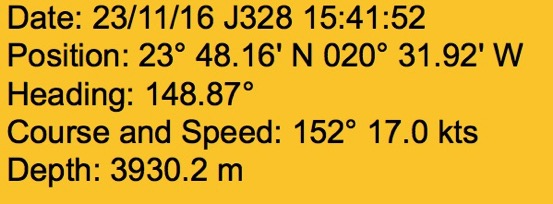
Ship’s log showing a record-breaking 17kts on route to rescue the crew from the stricken yacht ‘Noah’.


The 36ft yacht ‘Noah’ was taking in water fast and the crew of three adults and two children told us they were preparing to abandon ship in their small inflatable life raft. With some anxiety over the threat to the safety of the yacht’s crew, Jim, our captain, requested Bob the chief engineer to give the RRS James Cook full power to all four of its engines. Making a record 17 kts, we arrived within an hour and in time to find the ‘Noah’ sinking and her five members of crew in a yellow life raft.
Stricken yacht ‘Noah, just a few hours before it sank, with her life raft containing the crew of five including two children.
The Grefrath family: skipper Alexander, his wife Alexandra, their two sons aged 10 and 12, and fellow crew member Jörg Zeibig, had left Grand Canaria on the 20th of November on route to St Lucia. Just after 2pm Wednesday, they sent an SOS message out saying their yacht was taking in water. Their pumps were overwhelmed and they were sinking. 
The officers and crew of the RRS James Cook displayed the highest levels of seamanship in rescuing the crew of the ‘Noah’, bringing them safely aboard without any getting wet or cold.

The crew of the RRS James Cook handled the situation professionally and with great seamanship. First off the life raft was Jörg, followed by Alexandra and the two kids. The last to leave was skipper Alexander. All climbed aboard the RRS James Cook safely and were given blankets and shown to the chief scientists quarters for the duration. Despite their ordeal, the kids soon settled in and within a couple of hours had found a play-station in the lounge and were playing the racing car and football games. The following day, the rescued crew were taken on tours of the science labs, the AUV and ROV. Bob put on a special tour of the engine room, which the two kids especially enjoyed.
The Grefrath family being given a tour of the ROV ‘Isis’ by Ross (left).

After going back to retrieve our AUV, we steamed to Tenerife to drop the family off in the early hours of Friday morning. To save time, we had the shortest port-call on record, with the gangway put down and hauled back up in just 30 minutes. Jim made a phone call to headquarters and we were allowed to use three engines on our way back to Tropic Seamount. This uses a lot more fuel and special permission was required. As a result, the rescue and detour only cost us 60 hours; a small price to pay for a happy-ending to an otherwise harrowing ordeal for the crew of the ‘Noah’.
The ship’s company gives a warm send-off to the crew of the ‘Noah’.

Monday, 21 November 2016

JC142 cruise blog #3 – Geological sampling by Pierre Josso (MarineE-tech post-doc)

The half-way though milestone (known as hump-day) of the cruise has just passed! We now have a much better idea of what lurks beneath our ship, typically at water depths in the range 1000-3000m. Nearly complete surveying of the summit of the seamount by the AUV has produced excellent and detailed imagery of the sunken volcano to guide our latest ROV dives. This imagery has helped us target sediment free areas for sampling. As previously indicated, the ROV can take multiple tools depending on the objectives of the dive and one has been specifically designed for this expedition: a new rock drill. With a key objective being to study variation in the composition of the crusts in relation to depth and other morphological features of the seamount, it is of great importance to be sure that the piece of rock you are collecting on the seabed actually comes from where you think it does. This may be a problem on the flanks of the volcano where slopes of 15 to 45° are likely to result in debris moving down slope from outcrops at shallower depths. The top of the seamount is relatively flat and sometimes exposures only offers scarce loose rocks for us to pick up with the manipulator arms of the ROV. This is where the drill comes in to its own.

The rock drill is assembled on the front of the ROV for its next mission, behind is crate containing core catchers for extracting the core from the drill hole, and boxes for storing samples during the dive
When the geologist in the ROV shack sees an interesting pavement of crusts (only a geologist will say that apparently!), he gives the signal for drilling. With a barrel of 30 cm, the diamond drill typically manages to produce a complete core in about one hour. Probably not the most exciting part of dives but one of the most important and delicate operations as the drill needs to go down as straight as possible for us to recover the best sample. It took a few tries to develop the best drilling strategy…indeed a few core catchers got stuck in the seabed or the core couldn’t be recovered, but the ROV team did a great job adapting to the challenging drilling conditions and our technique (this is the first attempt at seabed drilling for them). The drilling is now as good as it can probably get. It is notable that, as far as we are aware, this is the first time ever that seamount Fe-Mn crust deposits have been sampled with an ROV-mounted drill. The drilling part of these missions (which can last for up to 24 hours) provides a short break from the almost continuous seafloor observation/mapping that the scientists undertake. The drill seems to be a particular attraction to the local crabs and shrimps, curious about this bright intruder in their dark environment.
One of the many platforms found on the top of the seamount encrusted by iron and manganese, a perfect flat platform for ROV drilling.
The drill is deployed and running with a constant weight applied by the two iron blocks lifted onto the rig once the drill bit is on the seafloor. Brown dust indicates we are drilling through crust!
As the drill goes deeper, the plume changes colour as we attack the sedimentary platform under the crusts.
In this lateral view of the drill, our sampling attracts the local residents curious about this noisy intruder. 

The drill has completed a hole in the seabed, time to grab the core, still in its hole, using the core catcher shown! The laser beams are 10cm apart.
One of the many samples we have recovered during our dives (laser dots are 10 cm apart).
During the cruise we plan to acquire a dense grid of cores to study changes in crust composition at the meter, hundreds of meter and tens of kilometer scale, with control over the location of each sample. These will be complimented by grab samples of rocks. An untold competition runs between the two science shifts to see who will bring back the biggest slab, and the race is tight as samples in the 20 to 25 kg range have already been recovered! These big pieces of rocks provide the opportunity for us to study the lateral and vertical variations in these deposits at a small scale. In total, 70 kg of rocks per dive can be acquired, if we do not take the drill or other heavy equipment. It will always be a trade-off between equipment requirements e.g. taking the drill and sample capacity on this vehicle.   

Once the ROV dive is finished, we usually have a good hour to get ready for handling the samples as the ROV is recovered from the seabed. In order to quickly process and preserve the samples we have to work as an efficient team transferring them to the lab where they are photographed, cut into slices and described before being bagged and stored for further analysis back at base. 
Back on the deck, samples are cut carefully…
…. photographed and described.
One of the cores extracted from its barrel showing crust above the phosphorite substrate.

JC142 cruise blog #2 – First Dives by Sarah Howarth (PhD student)

After two days transit we arrive at Tropic Seamount. The first piece of equipment to go overboard is the CTD (conductivity-temperature-depth) rosette. This is a series of bottles that can be lowered and then opened at specific depths to allow us to sample the seawater at different depth of the water column. With a rosette of 24 bottles that can carry 20L each, this is a lot of water to process! This time the water collected is used to sample the microbiology at different depths.

The Autonomous Underwater Vehicle (AUV), Autosub6000, is the next to go in for a 12-hour high-resolution mapping mission of the summit. This is vital information for later dives and allows us to pinpoint potentially exciting areas to explore in later dives.

Early morning start for the first AUV mission of the cruise to map the summit of Tropic Seamount.
Isis, the ROV on JC142, is used for seafloor observation and sampling, armed with 3 video cameras, 2 manipulator arms and a selection of tools that can be added depending on the main aim of the dive. Today’s aim is a 22-hour dive to deploy the lander and undertake reconnaissance on the SW area on the seamount summit. During dives seafloor observations from the ROV cameras of both the biology and geology are used to map changes in environment. 
Isis returns from the first dive for reconnaissance and the trial plume generation experiment. Samples are ready for sample processing- including one large sponge on an even larger FeMn crust slab.

First FeMn crust.
The geologists constantly ask resident marine biologist Lissette Victorero what the different sponges are called. A fish with legs adds 5 minutes entertainment to a 30 minute stretch of otherwise monotonous sediment. Sample collection is one of the most exciting exercises during dives and when the ROV comes up 22 hours later it’ s like Christmas has come early. With the ROV on deck the geologists and biologists collect the samples ready for cutting, bagging and distribution during thesampling parties.

The scientific party is split into two teams who do 12-hour shifts, from midnight to midday and vice versa. This allows for time at sea to be optimized and for round the clock investigations. The timetable for life on board is easiest to follow by the meals: one team lives by breakfast/lunch and the other by lunch/dinner. It does lead to some confusion saying good morning at midnight but it’s a good sign that you’ve settled into your shift pattern. Down-time is spent relaxing in the bar, watching movies, playing table football and most importantly, sleeping. 

Last Monday, we saw the super-moon, apparently the brightest and biggest since 1948. The sea was lit up by an eerie silvery light . With clear skies, the sight was quite breathtaking and drew lots of the ship’s company out on the foc’sle deck where there are no lights to spoil the effect. 


Thursday, 17 November 2016

JC142 cruise blog #1 – Setting the scene by Chief Scientist: Bramley Murton

Saturday 29th October, cruise JC142 left Santa Cruz, Tenerife, bound for Tropic Seamount, some 300 nautical miles SW of the Canary Islands.  We spent the preceding day on a geology field trip on Mount Teide, the islands tallest volcano. Teide is the 3rd highest volcano on Earth, rising almost 8km from the deep seafloor. The evolution of Teide and Tenerife has echoes in the formation of Tropic Seamount. On Tenerife we walked into the huge caldera and looked at the more recent peak which forms the summit of Teide. We examined cinder cones, lava flows and crystals, and discussed the distinction between minerals and life; crystals reproduce their unit cell structure and grow from chemical and energy gradients; the basic building blocks of life do much the same.


The RRS James Cook preparing to sail for Tropic Seamount. Our banner says it all, “Securing critical marine minerals for a sustainable low-carbon future”. Ferromanganese crusts forming on some ancient seamounts are rich in rare metals that are essential to making ‘green’ technologies like solar panels and wind turbines.


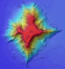
Tropic Seamount is one of a small province of 100 million year old underwater volcanoes SW of the Canary Islands.
Tropic Seamount started life about 120 million years ago, just after the Atlantic Ocean was born. At that time, the Atlantic was only as wide as the Red Sea, and Tropic Seamount was a palm-fringed volcanic island surrounded by a coral reef. Over the millennia, Tropic Seamount slowly sank beneath the waves. As it did so, the sea eroded the peak, giving it a flat top. Earthquakes shook the volcano causing its sides to collapse. We see the result today, a star-shaped, flat-topped seamount of the type called a gyot. Although much diminished from its former grandeur, Tropic Seamount is still 3km high and covers twice the area of the Isle of Wight.

The aim of our mission here is to understand what controls the formation and precipitation of cobalt-rich crusts on seamounts like Tropic. These crusts are potentially rich resources for scarce elements that are critical to new technologies and especially those that are used in low-carbon energy production like solar panels and wind turbines. While some seamounts are rich in these crusts, extraction of the minerals is also harmful to the immediate environment and part of our work is to study the potential impact of deep-sea mining.

During our mission we will be deploying the latest technology. The ship will use its sonar systems to map the seamount at a resolution of 25m2. This provides a base map and shows us where the hard and soft rock and sediment is distributed. We use this information to map the seafloor with our robotic submarine, Autosub6000. This yellow submarine is torpedo-shaped and is sent off on its own for 24 hours at a time. The images it brings back reveal the seafloor in great detail – with a resolution of 1m2 for the bathymetry and 25 cm2 for the acoustic sidescan sonar pictures, showing minute details of the crusts and sediment pockets. Once these images are back on board, we chose sites to dive on with our remotely operated submarine, Isis. This vehicle hangs on a cable and we control it from a room in the ship.

 
Ella launches the Autosub6000 robot submarine from the stern of the RRS James Cook. Autosub6000 is autonomous and maps the seafloor during 24-hour missions on its own. The sub can dive to 6000m below the surface and make sonar images of the seafloor in astounding resolution and clarity.

The remotely operated vehicle ‘Isis’ is launched over the side of the RS James Cook. This robotic submarine is controlled from a room onboard. We use it to drill and collect samples of the crusts from the seafloor. We also use ‘Isis’ to conduct experiments to simulate the effects of seafloor mining and the potential impact such activity might have on the surrounding environment. Isis can dive to 6500m below the surface and operate for days without a break.


Inside the ROV 'shack' – operating the ROV is a complex task and requires the pilots and scientists to work closely together.


The lander is placed on the seafloor by the ROV and waits for the first of our experiments to generate a sediment plume.


The ROV holds a hose as it blows a sediment plume in the water up-stream from the lander. This is the first time every that an experiment has been done to simulate the potential effects of disturbance from seabed mining on the surrounding environment. It is widely thought that sediment plumes can spread far and damage vulnerable animals such as sponges and corals. We aim to explore this by conducting small-scale experiments 1000m below the surface on the seabed.


One of our aims is to explore the potential effects of deep-sea mining on the surrounding environment. For this we have built a seafloor observatory, called a seabed lander, to image and measure dust plumes as they drift across the top of the seamount. The lander is deployed by ‘Isis’ which generates sediment plumes in the water. Modelling and monitoring of the currents allows us to predict how fast and how far the plumes will drift. We position the ROV up-stream from the lander, at different distances, and generate the plumes over a period of several hours. We plan to use the Autosub6000 to swim though the plumes at a distance of 1km. This information will be combined with an ecological study of the distribution of the animals most vulnerable to sediment disturbance to assess the potential impact of seafloor mining. 

While modern civilization needs rare elements found in these deep-sea mineral deposits to function and reduce our overall planetary environmental impact, we have a duty to assess the impact that extracting these minerals may have on the immediate and local environment. These data will help shape future regulations and laws around deep-sea mining.